With a little conditioning from our short hikes under our belts and a decent weather forecast, we headed out for our first longer hike yesterday. We started at the beach at Lostmarc’h, which is on the southern section of the trident-shaped Crozon peninsula. The beach is split into sections – one for surfers and one for swimmers. Despite being long, the surf was crowded with three dozen or so surfing students. It looked a little hazardous, since many of them didn’t have very good control of their boards.

Seeing swathes of blooming heather is one of the many pleasures of these coastal hikes. It was rather concerning to see a lot of dead plants on the first part of the hike.

Fortunately, the dieback wasn’t too widespread:

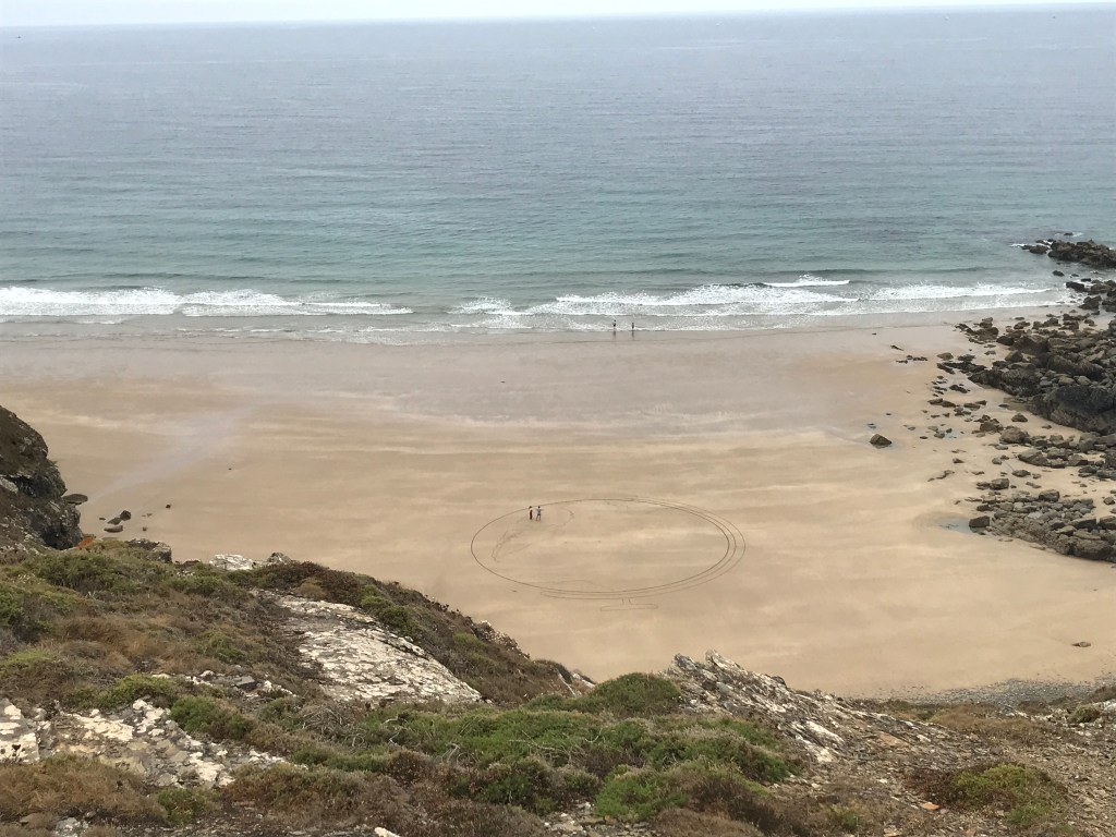
Our destination was the Pointe de Dinan, where we had started a hike during our last visit (see the post here). Along the way, we saw people down on a beach doing a very large drawing in a circle drawn the sand, but we couldn’t tell what it was going to be.
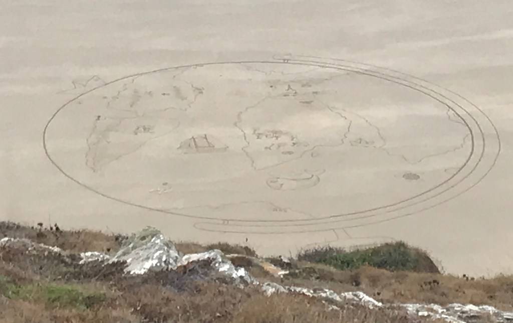
On our way back, it was obvious…and impressive!

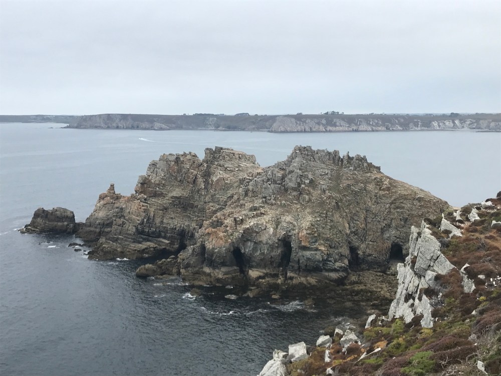
The château de Dinan (Dinan castle) was just as attractive as we remembered, though with a whole lot more people milling about.
A heavy mist made the hike back a little damp – and unphotogenic.

